

|
|
On Wed July 14th and Thurs 15th the most intense thunderstorms of the year broke out across Ireland and N. Ireland in a high instability environment associated with a low pressure system crossing the country from the southern Atlantic Ocean. Powerful pulse-type storms produced hundreds of cloud to ground lightning bolts on both days along with several funnel cloud reports. Unfortunately for us we ended up busting on both days due to not trusting instincts and by having no mobile internet access, however it was far from a complete loss as we did catch some great storms clouds, night lightning, and thunder, so we didn't come home empty handed, in fact, I reckon I had 50 images taken over the last two days so perhaps the word 'bust' is not entirely justified, this account covers both days.
Wed July 14th
Good forecast out with over 1000 CAPE and LI's between -2 and -3, set-up was rather unusual since the flow was coming from the SE associated with a warm sector ahead of the LP moving N. The forecast was for pulse storms however there were some concerns such as warm air aloft and little in the way of shear so storm organisation was not likely, convergence was most likely in the W side of the country where funnel clouds and weak tornadoes were possible. The main concern for NI was solar insolation, if this didn't happen then storms would not fire without a trigger so we were hoping to see the Sun from early in the day, this did not happen. A frontal system moved through during the night and remained over N. Ireland through the morning and by the afternoon we were still clouded out with no breaks at all which concerned us greatly. Frontal cloud was quick to clear over the Republic of Ireland and storms fired up rapidly by early afternoon and soon they became spectacular and widespread. We were hoping as the centre of the low moved N that the cloud would clear from here and storms could fire but it was getting fairly late on into the day and there wasn't a single sferic in the N to be seen. Conor McDonald and I had come to the conclusion that it was game over and that was when the storm-staved depression arrived. What made things worse was that we had considered going to the border this morning, even over it, but decided against it and now it was too late to go. The best storms of the year where popping out lightning over the entire W country and we should have been there.
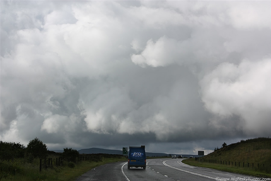
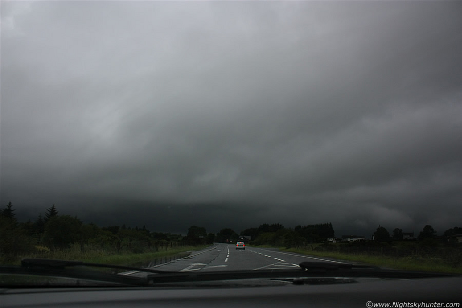
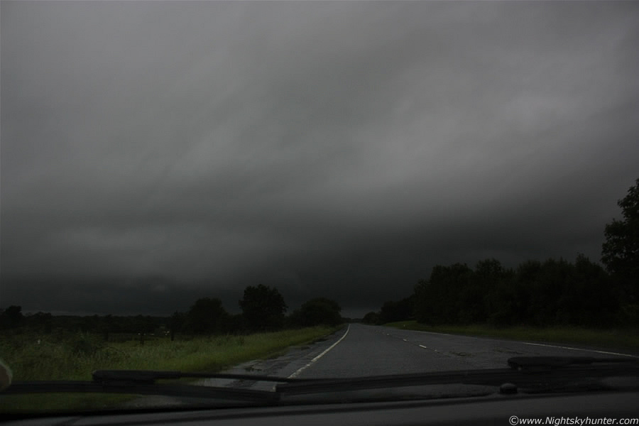
By late afternoon things changed rapidly, the obscuring cloud began to break allowing some sunlight in and it wasn't long before stunning convection could be seen arriving from the E and SE. A phenomenal cell with huge black solid erupting towers suddenly appeared in the E and moved across the N skyline close to where I live, the central tower was brilliant white and it looked a serious deal as it drifted across the sky at a rapid pace demanding attention, it was soon followed by others which looked so good that I wanted to be out on the road watching them. The atmosphere was literally exploding with convection and it was time to get a plan in action. I rang Conor and quickly discussed that stunning cell we saw earlier then decided to get out, Conor was driving today so he picked me up shortly after the phone call and we where on our way up the Glenshane Pass on high ground in search of a good vantage point, on the way up the steep climb another cell crossed the road in front of us producing heavy rain so when we pulled up at our location on a country road we where directly under it. We had to sit in the car for a good length of time waiting for the rain to stop, when it eventually did we got out and took in the visual scene.
We were not impressed, visibility was awful due to the outflow from those cells and showers, it felt cool and damp like a grey Autumn day, it was hard to believe this was actually Summer. There was even dense mist and fog all around us blocking our view of any storm structure not to mention wiping out the horizon completely, we were doubtful about getting storms or even any good convection under this stuff, after the worst storm year we have ever seen we just couldn't face another damp squib, especially with the best CAPE of the year so far, it was too much to bare. The sky was white-grey in colour in all directions and low cloud could be seen rising upwards from the Glenshane valleys like steam, the atmosphere was not good so we decided to get back in the car with the intention of going to lower ground and eventually back home.
We where just about to drive over the Cattle grid onto the main road when a car pulled up along side us, it was another Maghera storm chaser, Declan O'Doherty, we couldn't believe it, considering that there are so few people who chase in this country it was amazing that we bumped into another one here, the encounter really lifted our spirits because it felt a relief to know that someone else was out there doing the same thing. We ended up chatting for a long time and discussing the storm potential, comparing cameras and our thoughts for the day, it wasn't long before we were all buzzing with energy. It was then that the mid level cloud and low mist began to vanish and the Sun broke out once again, within min's we got treated to the most explosive convection of the year!.
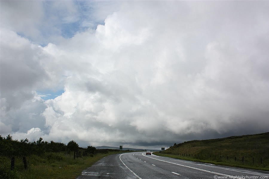 |
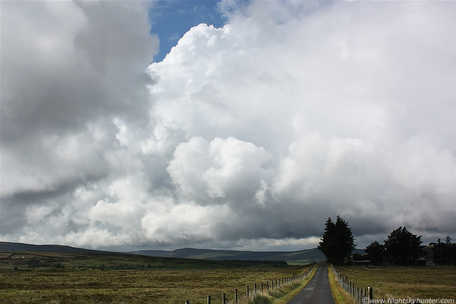
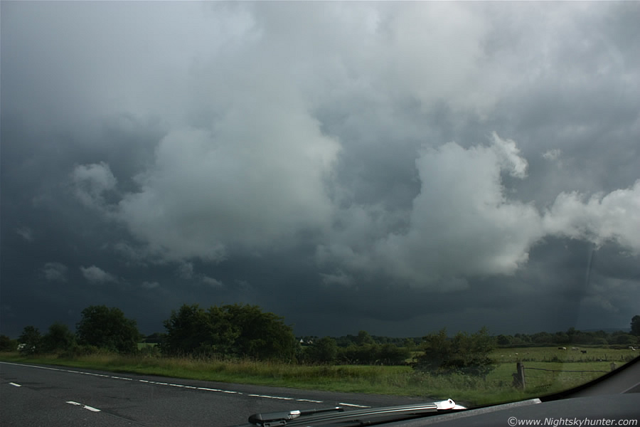
It was like a switch had been flicked, one min it's cold and grey, the next there's heat, humidity, and enormous storm clouds bubbling ferociously upwards and with the clearing cloud we could see the true extent of it. There was a huge line of remarkable convection stretching from the SE horizon to the NW and it was moving fairly swiftly too. Conor and I agreed that this was the most spectacular convection we had seen this year and by far the most photogenic to date, good job the Sun was out to bring up the intense white colour on the W flank of the convection. I walked over the Cattle grid and began shooting the scene. This is looking W along the main road on the Glenshane Pass, the same place which experienced the extreme blizzard back in March.
 |
The line in these images extends out of frame to the R and would require at least five 18mm frames to show it's full length. The line is moving from R to L and away into the distance, almost following the road. This is the kind of convection I like to see - huge, solid, exploding with energy, and surfaced based which means the bases are close to the ground at the lower levels of the atmosphere. Low level convection is always more nasty looking and a better subject for photogenic storm structure, this surface based convection is more likely to produce funnel clouds and tornadoes.
 |
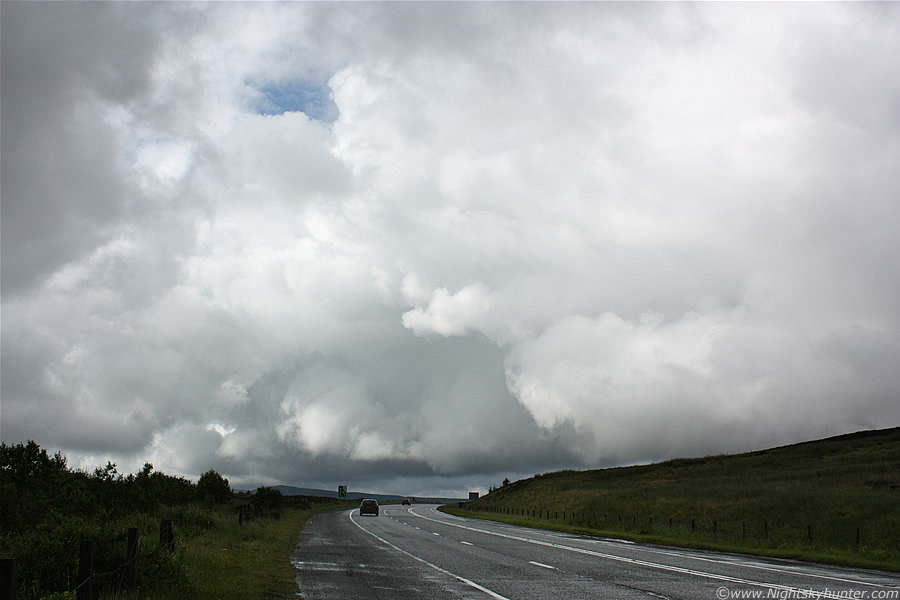
This possibly could have been some sort of convergence line because the strongest convection fired up on it for hours and it never seemed to disappear, by that I mean when the lead cells moved away to the NW then new cells would develop at the rear and shoot up into mature convection, this cycled over and over again. The line consisted of towering cumulus (updraught towers/congestus) and cumulonimbus calvus cells. The majority of the convection was 'dry' meaning that there were entirely inflow based with no precip breaking out at this stage which meant no electrical activity, it was actually shocking we didn't get rumbles from this stuff since the cloud tops were truly gigantic and considerably more than high enough for sparks, I would love to have got atmospheric soundings from the day and find out how many tens of 1000's of feet above the ground they where. We were all taken in by this convection and considered it a very good sign, especially for this time of the evening when the Sun was now triggering convection when the highest instability was over central Ulster, this was LI's of -3 in action here which is fairly decent for here!.
 |
The good thing about having primarily inflow based powerful convection is that you have a considerably greater chance of seeing funnel clouds and even tornadoes, and with no precip falling you have good conditions to spot them as long as you have a good horizon where you can see the cell bases. If you want to increase your chances of capturing a funnel or tornado in the UK or Ireland then get in the habit of watching strong convection/cells initiating, this is especially likely just before the storm enters its mature stage, after that the inflow gets swamped by the outflow which weakens the updraught unless you have a very well organised cell in a high shear environment. The exception to this pre-mature rule is from cold fronts and squall lines which produce tornadoes in a different set-up and often embedded within heavy rain, these kind of tornadoes can happen here during the Autumn and Winter months from active cold fronts and can be very strong.
 |
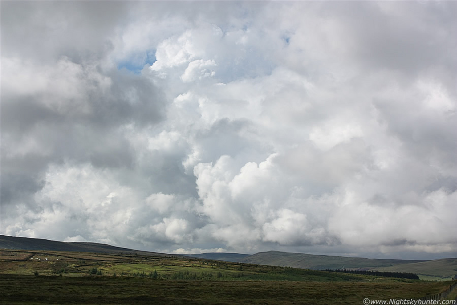
Looking in the direction those cells where going I knew at this moment in time that we should have been further W in the Donegal area or slightly further S along the coast, later I found out that good storms had indeed fired there. I really loved the sight of this line, the storm clouds are just above ground and extend far above the camera frame high into the sky towering so high that they looked very sinister. I was carefully watching those bases for funnel clouds, there was no question that with convection of this standard we could get one spinning down from anywhere in that line, the view to the N was blocked by the mountains so I could only monitor what was happening in this direction.
I was so fixated on this line that I forgot to watch the rest of the sky, Conor called me back over and pointed out new areas of interest, there was no question that things were really happening, everywhere we looked there where storm clouds boiling like mad so went back to Declan's car and spent some time looking at the radar and sat images, we could see those fantastic storms over W Ireland, England, and huge anvils on the Supercells over Europe. We decided to drive back up the road and parked on high ground, Declan drove up and joined us. This must be the first time there's been a storm chaser meeting in N. Ireland and it felt great, even though there was only three of us it felt like the beginning of a new era, I had the strong sensation that this subject is going to become big in this country with storm chasing fast becoming extremely popular, I can also imagine many more photographers getting involved in the action.
I can see a bright future for chasers in N. Ireland and the Republic, I'm actually amazed by the amount of emails I've been getting from all over the country from people who are fascinated by the subject, each of them have a story to tell about a fantastic storm they saw, interestingly a large percentage of storm-lovers here have been female. I've been getting such great synchronicity with storms lately, I was at Portrush last weekend and ended up chatting to a stranger as we stood admiring the Ocean when I brought up the subject of storms, turns out the guy's friend had his caravan thrown through the air and ripped apart by the tornado which passed through Nut's Corner a number of years ago.
 |
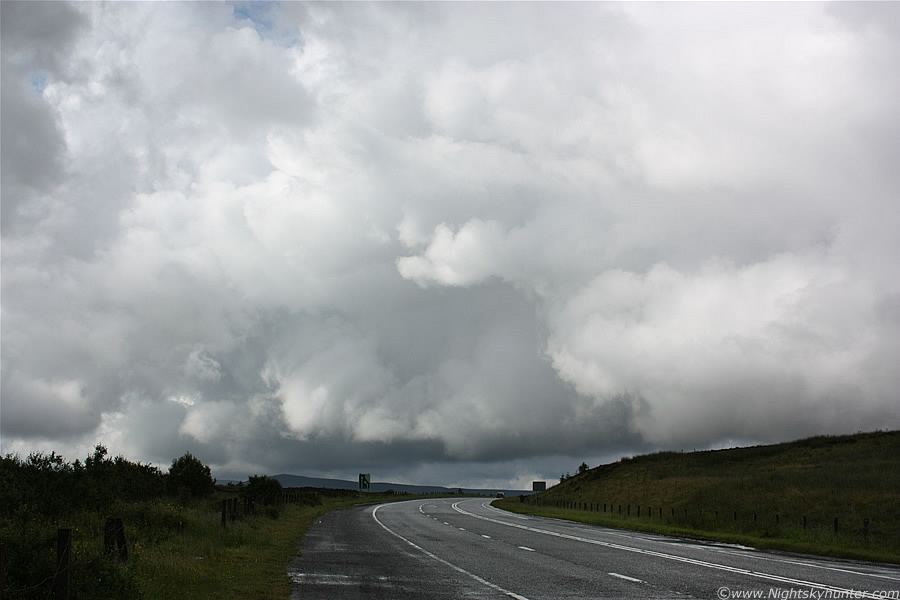
Our new position on that narrow road, image is facing N to NW, that's the leading edge of that same line of convection as it heads into the distance. Those cells are many miles away yet look at the size of them, recall that the line extends out of frame to the R, over my R shoulder, and behind me all across the sky. Look to the L of the tree, there's a very thin lowering of scud with a bend hanging down from the base of the central updraught base, it looks a little like a distant rope funnel, I never noticed it at the time but I'm it's nothing more than scud.
 |
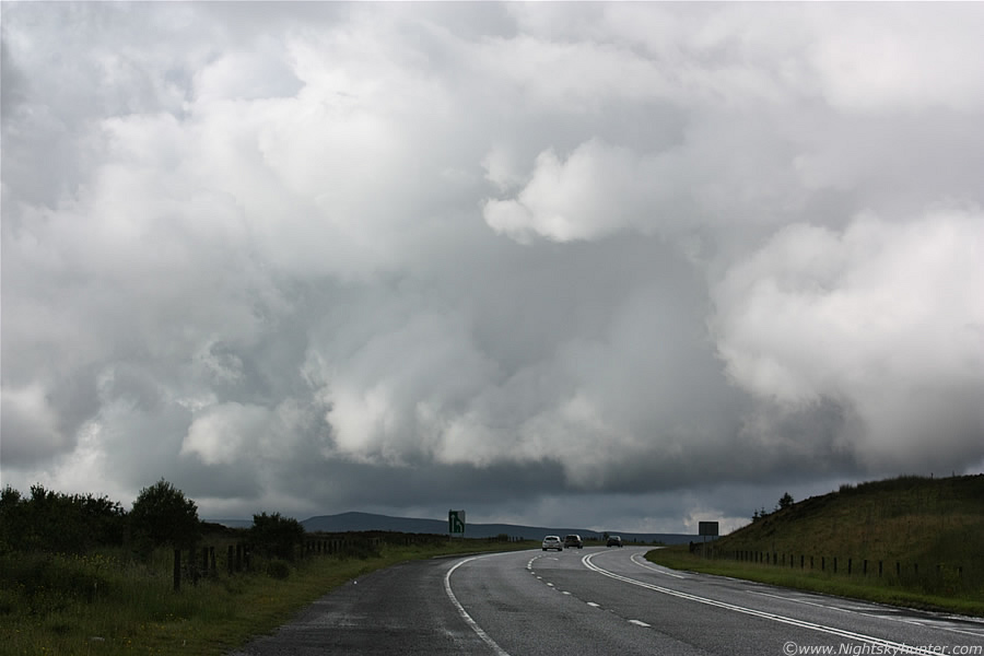
Looking NW over the mountains, a valley is located on the other side of that hill (the closer one) which sweeps down onto the main Glenshane Road which snakes between the mountains to the L in the direction of Dungiven. Above is literally a mountain of storm clouds with solid bodies and crisp tops expanding by the sec, to put it in perspective those towers are taller than Mount Everest! (which is 30,200ft). It felt great standing out here in the humid air with Conor and Declan watching nature at work with cameras out shooting convection and lap top on the car roof. Using Declan's mobile internet we checked out just about every convective resource we could find, we even looked at the latest GFS update for our next chase the following day and made a rough plan of action. Meanwhile the convection all around was pure eye candy, clouds which seemed small and of the cu med species expanded into monsters as they approached us, there was so much going on that we were constantly turning in circles to study a new base or marvel at the height of a calvus tower, there was a great deal of pointing and discussing the merits of the clouds and what they were capable of.
The focus of our attention was that same line at the back of the above images, this thing was visible in the SE away beyond Slemish Mountain, perhaps even over the coast itself if you count the smaller convection moving into it. On the NW side it continued over the Sperrins and probably away in the direction of Dungiven, possibly even towards Co. Derry, so it was tens of miles long and generating new convection like clockwork. The E side of it looked very good with long dark base and solid crisp towers far above, we really thought this was the one which would produce one or more funnels however no joy this time, precip broke out in several places below however much to our astonishment it remained silent, there was no thunder from it, perhaps due to the warm air aloft which hindered the growth of ice crystals and electrical activity despite their high tops. I don't know how long we spent here but it seemed like 2-3 hours and it was already well into the evening, it was great fun though, there's nothing better than sharing your passion with other like minded people. We decided to call it a day, get something to eat and go back out again if anything kicked off, the plan sounded good to me as I was starving. Conor I headed home down the Pass and watched more big cells move across the sky but we let those cells go.
Back at home I had dinner then checked out the back door when I saw more great convection firing, my Aunt was visiting at the time and she asked about the clouds (noting my excited voice) so I pointed one out to her and explained all about the structure, how it formed, and what it could produce and she seemed genuinely fascinated. Later I checked the radar and sferics charts and felt sickened, we had missed the best storms of the year, W ROI and NW Ireland had phenomenal storms with 100s of c-g strikes and beautiful anvils, we should have trusted our instincts and went there instead, this was a tough blow to take and we felt very let-down once again in what has already been a let-down year for storms (until this time anyway), I was beginning to wonder when we were ever going to get a break.
After sunset the latest GFS showed just enough CAPE over the Irish Sea, NE Atlantic, and N shore of NI (200-400) for the possibility of night time thunderstorms, none were mentioned on the forecast but it was logical to assume that any storms moving into that environment could stay active, especially from nocturnal cooling. Radar showed storms moving from Wales across the Irish Sea with strong echoes over the Isle of Man and more on the E coast of Scotland, if they stayed active there and crossed the Sea then we could get some action, we decided it was worth the extra effort and came up with a new plan, we could drive to the N coast immediately.
This time it was my turn to drive, Conor and I got our gear ready and hit the road and headed N towards the coast. On our journey there the sky was already dark and overcast, we where sure as we approached Coleraine that we could already see lights reflecting off precip further N so that was a good sign. We were here by just a last min split sec decision, after the bust earlier we were determined to push out more dedication in the hope of getting rewarded and we really began to get a good feeling the closer we got, there wasn't a single flash of lightning in the sky since we left Maghera so it may have seemed hopeless to some, however we had confidence in our own forecast.
I don't know exactly where we ended up but it was somewhere between Portrush and Ballycastle, we found a little carpark in the middle of nowhere which was shrouded in darkness, it was so dark here that I couldn't see much at all but when my dark adaption kicked in I could make out the Atlantic Ocean below. We found a muddy narrow trail which was designed for ramblers and followed it for a considerable distance along a very scary cliff, it was pitch black (no torch) and with nothing more than a few bushes on the edge, in complete honesty it was a very dangerous walk, one slip off that path and we would be over that cliff and onto the rocks and sea far below. We found a little flat clearing in the path and set up our gear there, this was again smack bang on the edge of the cliff face. The view from there was spectacular, we were looking N to NE across the Atlantic Ocean in the direction of Scotland and with the exception of distant lights it was pitch black, the sky was overcast and the air was warm and humid.
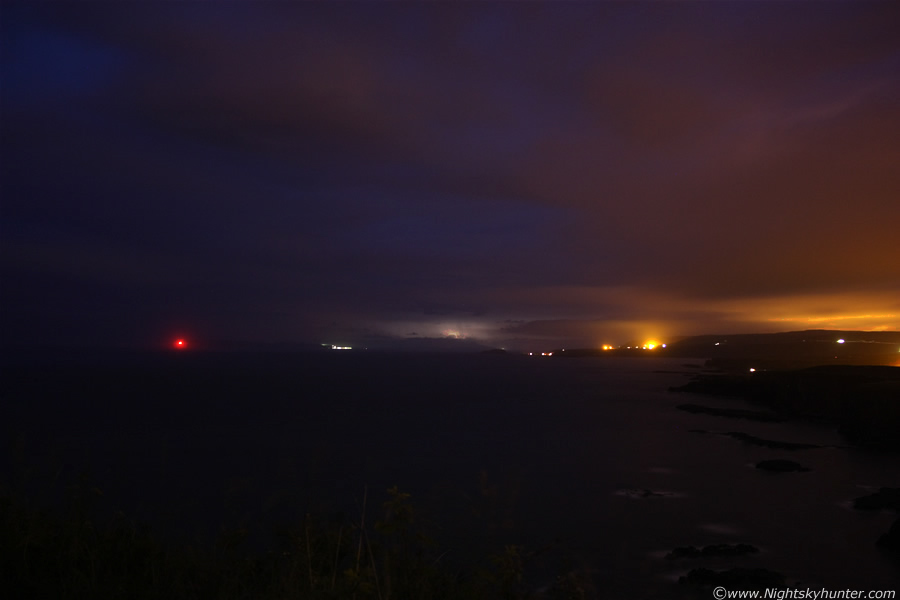 |
We had a good feeling about our decision, we just stood there facing out into the Sea, suddenly a brilliant blue flash of lightning lit up the sky from the direction of Scotland, wow!, that was seriously bright, we both cheered loudly as we had already succeeded, our forecast had been a good one. We began taking long exposures, it was so dark that the shutter needed to stay open for a very long time, I was actually taking exposures between 1 and 5 min's at ISO400 with the lens at 18mm. The next flash of lightning was stunning, this time it was a yellow-white colour as well as blue at the same time. The blue sky in the image is actually the blue lightning catching the clouds above. I could actually see the cell light up from within like a light bulb by an in-cloud (I-c) bolt which was amazing, I even caught it on camera. This exposure is 123 sec's, it was a good exposure because the bolt flashed late into the exposure allowing me time to gather light beforehand to show the Ocean and shore. To the R you can see the rocky shore with waves, to the far L is a red light which belonged to a buoy floating on the Ocean, the cell with lightning is clearly visible between the buoy and lights on shore, we suspect Rathlin Island could also be visible on the horizon but we are not certain.
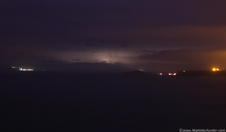 |
Crop from the 18mm frame, it felt fantastic to see night time lightning again and even better to get it on camera, that cell was on the shore of Scotland and easily 30 or 40 miles away so it was very far indeed, had it been closer this would have been an amazing photo opp, despite this distance handicap I decided to post these images anyway just for the pure fun of the night. The I-c bolt really stands out in this crop, even falling precip between the cell and us has been illuminated by the flash. Cell is moving very slowing from R to L further out to Sea.
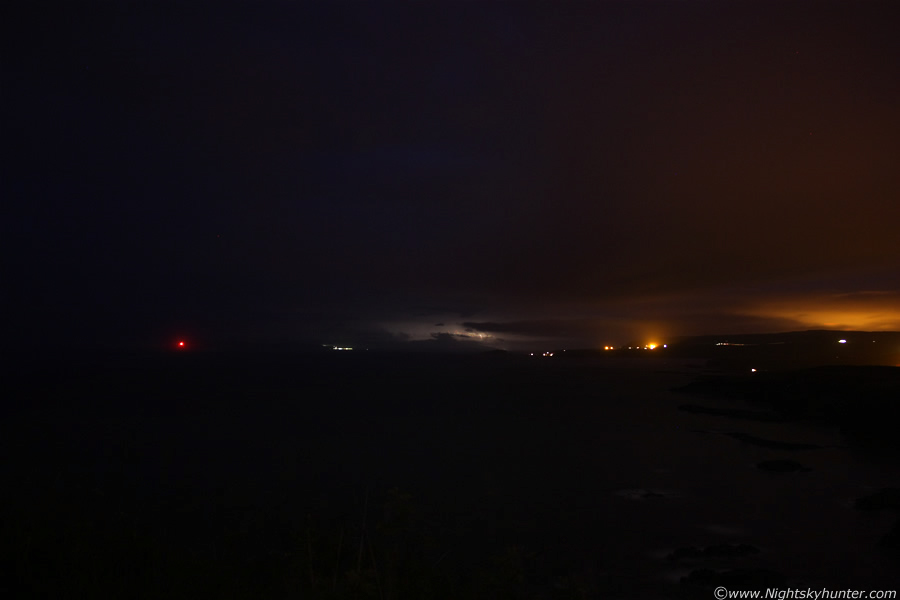 |
I caught another one, this time it flashed too early into the exposure, if I had left the shutter open longer after it the image would blur and the bolt would get covered by moving cloud so I ended it at 53 sec's, it still picked up the bolt very well, in fact, this is my favourite of the two, the darkness is fairly similar to the naked eye view at the time.
 |
Crop from the second 18mm frame, it felt so magical and surreal standing on this dark cliff watching these incredible flashes of lightning which where literally over another country, it was completely peaceful, calm, and quiet, the only sound was the periodic subdued rumble of the Sea breaking against the rocks below which coincidently sounded a little like thunder. We observed five well spaced flashes during the session, not alot however it was the first night lightning we had seen since March 2009 so it was long overdue, those five flashes were like heaven on Earth and were hard earned I can tell you. The lightning stopped and it began to rain so we made our way back along this path, this time using the flashlight built into my mobile phone which I had forgotten about on the way over. We made it back home at 03.00 BST, it had been a long day and thrilling night and we both felt exhausted, we still had the following day to look forward to.
Thurs July 15th
This was the biggest day of the year so far with +1300 CAPE, LI's -4 with a flow between Sly and SWly with convergence, cold air aloft in a classic post frontal environment, the only concern was solar insolation and little in the way of wind shear so more non severe pulse type storms were expected. Due to some convergence and outflow boundary interactions there was a risk of funnel clouds and weak tornadoes. The Met Office had a severe weather warning out for all of N. Ireland for heavy rain, flooding, and thunderstorms. I was completely exhausted after yesterday's chase and our late night storm watch from the coast, I went to bed at 04.00 and I actually dreamed about sat and radar images all night because I had been spending so much time monitoring them recently. I set the alarm on my mobile for 11.00 which I thought would leave me plenty of time, it went off and I slept though it, by 11.30 I got a text from Declan informing me that the Sun was out and the CAPE charts were still looking great to that got me up. Out the window I could already see good convection so I felt sure this was going to be a big day. I was shocked when I checked the radar, good echoes where already present just to the W of here and extending NE, there had already been lightning in Ballymena and Coleraine, things had kicked off early!
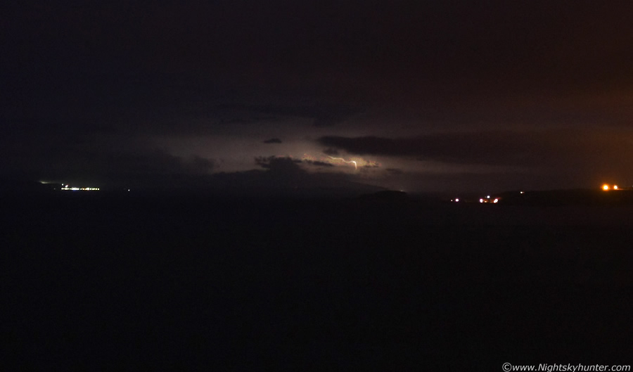
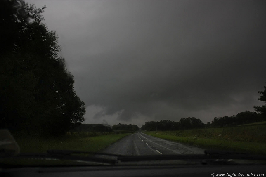
From looking at the convection in conjunction with the radar I was certain a convergence line was present, and with time this proved to be correct, my thoughts were that this was the line to be on today. And so began the usual routine of watching the radar and swapping phone calls with Conor all day, major storms broke out below the border and began to move NE, if they kept on their current track they would pass near Maghera later, the convergence line went quiet as far as sferics were concerned so we concentrated on the S storms, they where moving into Omagh and moving N, radar showed these meeting new showers which merged with the convergence line so we decided to head out earlier than usual and wait for them come in. We parked up on the Glenshane Pass again on the narrow road and just waited. The scene was similar to yesterday, cool, grey, with very low cloud and mist blocking the view so visibility was awful, we heard a big rumble of thunder far away to the S and began to get excited as those storms where moving in, after a long wait we hear another rumble, fairly distant but probably within 10-15 miles of us.
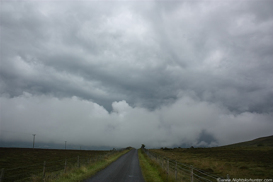 |
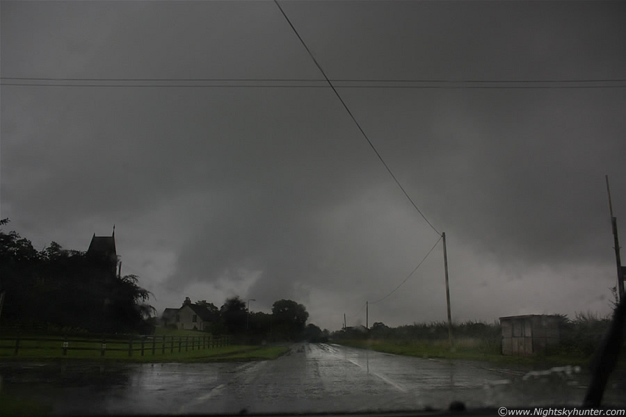
Then a brutal looking outflow boundary appeared from the S from the direction of Lough Neagh, this thing was huge taking up a large portion of the visible sky with solid looking body with a mid level cloud canopy sporting very unstable structure, the whole thing had that nasty looking very dark blue colour typical of storms, ahead of it a huge amount of moisture formed into mist and tall cu as the whole thing slowly swept towards us, then another long duration rumble could be heard from behind it. The mid level cloud shield covered the entire sky with amazing patterns, Conor said it looked similar to the clouds he saw in Australia ahead of supercells approaching, we began to get excited as we were sure there had to be a well developed shelf cloud in behind that low cloud, this had the potential to be the best structure shot of the year. We decided to drive on down this road onto lower ground in pursuit of structure, once we passed through all that low cloud we saw the corner of a big black shelf moving over Slieve Gallion, it looked decent enough for a shot but we couldn't get pulled over due to trees blocking the view so we kept on driving for miles for a decent vantage point, we eventually found it just in time to see the shelf collapse into mush so it was came over. Heavy rain fell so we drove back home to Maghera through huge puddles with a frown on our faces, was this it?.
Back at home the radar and sferics charts revealed all, we had busted on the biggest event of the year so far, massive storms broke out on that convergence line and stretched across the entire country from SW to NE with 100's of c-gs covering inland regions to the NE coast, there where also big storms further S and W below the Lough. We had made a bad decision being N of that line when we should have been S, also we had no mobile internet access and hence no idea what was going on. I ate my Dinner feeling defeated and annoyed with myself for leaving too early and ignoring that convergence line, there were funnel clouds too which made matters worse. Later a new storm popped up over Lough Neagh but it was moving NE and would soon be over Antrim and heading towards Ballymena so we decided to let it go as there was no time to catch it.
During the late evening I was just about to give up when I spotted a huge cell behind Slieve Gallion heading NE, it was still many miles away and looked to be trekking over the Lough, the cell looked solid with a bright anvil and dark base dropping nasty looking precip, I could see all this from my back door, that's how large the cell was. I decided to chase it, in fact my Mum and I went after it just for a bit of fun to end the day, the plan was to head to Ballyronan Marina and watch it over the Lough so we hit the road.
 |
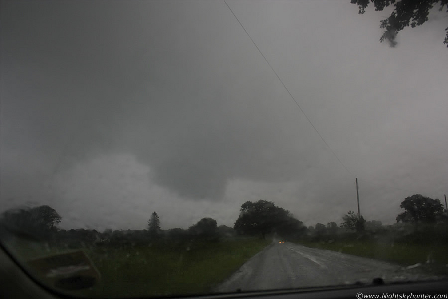
All these images were snapped through the windscreen as we advanced to the S. This is on the main carriageway between Magherafelt and Maghera. The view was nasty in that direction with bright cumulus pushed downrange by the outflow with the white colours contrasting sharply with the dark blue sky beyond where the cell lurked, you can see an intense core of precip in the distance and a little lowering which got my attention.
 |
We punched the cell's core between Magherafelt and Ballyronan, only thing was we never seemed to come out from the core which we had seriously underestimated, this precip line was huge, there was just no end to it, combine this with the size of the cell and its slow motion and you can imagine there was going to be flooding problems. The most intense torrential rain I have experienced this year fell here, the sky turned extremely dark and the rain was that loud that it made a constant rumbling noise, soon the roads were waterlogged and we encountered flooded sections, amazingly there was no lightning from this. A number of dark lowerings came into view straight ahead very low to the ground which looked sinister, there was no rotation but plenty of lifting motion, it was difficult to tell if there were inflow or outflow features, probably the latter, this was not one but a group of cells on the convergence line and we were directly under them.
 |
Getting closer to those lowerings
 |
They were alot bigger than they seemed earlier, my Mum thought a tornado was going to drop but there was little to be concerned about other than the dreadful road conditions. We finally made it to Ballyronan Marina and parked up looking across the Lough, intense rainfall fell the entire time, after a long wait a clearance arrived from the S showing new convection in the blue sky, we took advantage of the clearance for a quick walk along the Marina, the local Swimming team were out training. The rain was back on again so we enjoyed a well deserved ice cream from the local shop in Ballyronan (best around in my opinion) and began to drive home again, this was just before sunset.
 |
We met up with the back end of that convergence line on the main road home, it was a rather spectacular sight with huge storm clouds filling the sky and low to the ground turning day to night, the darkness under this thing was amazing, in this image the line of cells is many miles long and extending away out of frame on both sides while moving into the distance and slightly to the R. In the distance outflow scud, black in colour, could be seen displaying vigorous motion close to the surface which was impressive, at the rear was large sections of brighter cloud getting sucked into the inflow region.
 |
Look how dark it is under there, in reality it was even darker than this image which I took at ISO200. Not bad structure to the LHS either, looks a little like a bulging meso, however it was nothing of the sort. I thought for a while that this was probably just a big mess of cloud, those concerns vanished when a clear slot opened up at the back and I could see huge updraught towers exploding over the Sperrin mountains leading into the cell, this was showing red echoes on the radar. Since it was slow moving we eventually caught up with it and drove into the core again, more torrential rain, darkness, bad visibility, and flooding on the roads. When I arrived back at Maghera I witnessed stunning convergence, this huge line was moving SW to NE yet the mid level cloud was RACING from N to S over it in an incredible crisscross fashion, the entire sky for miles was doing this for a long time, the motion was so strong that I thought a vortex was going to form, I rang Conor and together we watched it while chatting over the phone.
It rained all night, heavy rain too with gusty winds, the radar at 03.30 looked amazing with the heavy precip wrapping around the centre of the low near the triple point, the entire scene looked like a small hurricane, quite amazing for July!. So that's the story of our chasing exploits over the last two days, it has been a busy time, we had been waiting on these big storms all year and when they finally happened we busted, however it was far from a complete loss, we did see the best convection of the year, cool storms clouds, night storms, and thunder so I guess we shouldn't complain. The Atlantic still looks active as I write this so I'm sure I won't have to wait long for another chase and a chance to redeem myself. Chasing is all about hit and miss, you win some you loose some, however you must never give up and remain dedicated because the event of a life time could be just around the corner and you don't want to miss it. I'm now ready for our next chase. Thanks for reading.
Martin McKenna